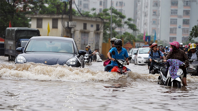
HSDC Maps is considered a very convenient and useful "flood" map for people on rainy days.
2.1| License: Free |
| Released: Cấp thoát nước Hà Nội |
| Request: Android 4.1 |
| Last updated: 22-04-2022 |
| OS: Android |
| Version: 2.1 |
| Total download: 856 |
| Capacity: 3,6 MB |
MENU
HSDC Maps is considered a very convenient and useful "flood" map for people on rainy days.
Inundation, heavy rain, traffic jams... these can be considered problems that will never end in Hanoi in particular and in other provinces across the country. country in general. Previously, we were introduced to Windyty - A weather monitoring application, allowing users to know which sections are raining heavily, which roads are about to rain to avoid.
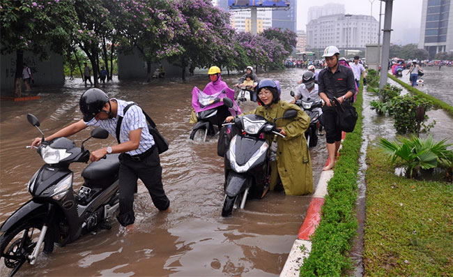
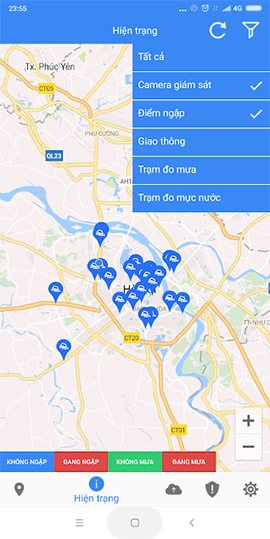
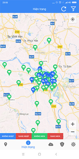
Rainy season is coming , if you've ever experienced the rainy seasons that caused Hanoi to sink into the sea in 2008 or 2016, used to suffer when driving a car or even leaving the house was a terrible torture, then use Using HSDC Maps will help you minimize this risk.
Currently, HSDC Maps has appeared on the two most popular mobile platforms, iOS and Android.
.
Google Maps APK is a world map application that makes locating an..
Digital Compass is a simple and easy to use application with lots..
Windy.com for Android (Windyty) is a very useful and useful perso..
Tracker Detect is an application launched by Apple for Android, h..
Google Earth for Android, the latest Google Earth supports visua..
5
4
3
2
1